10 Best Things to Do in Kvaloya Tromso: A Complete Travel Guide
Discover the best of Kvaloya Tromso, from the white sands of Sommarøy to 7,000-year-old rock carvings. Plan your perfect island road trip with our expert guide.
On this page
10 Best Things to Do in Kvaloya Tromso
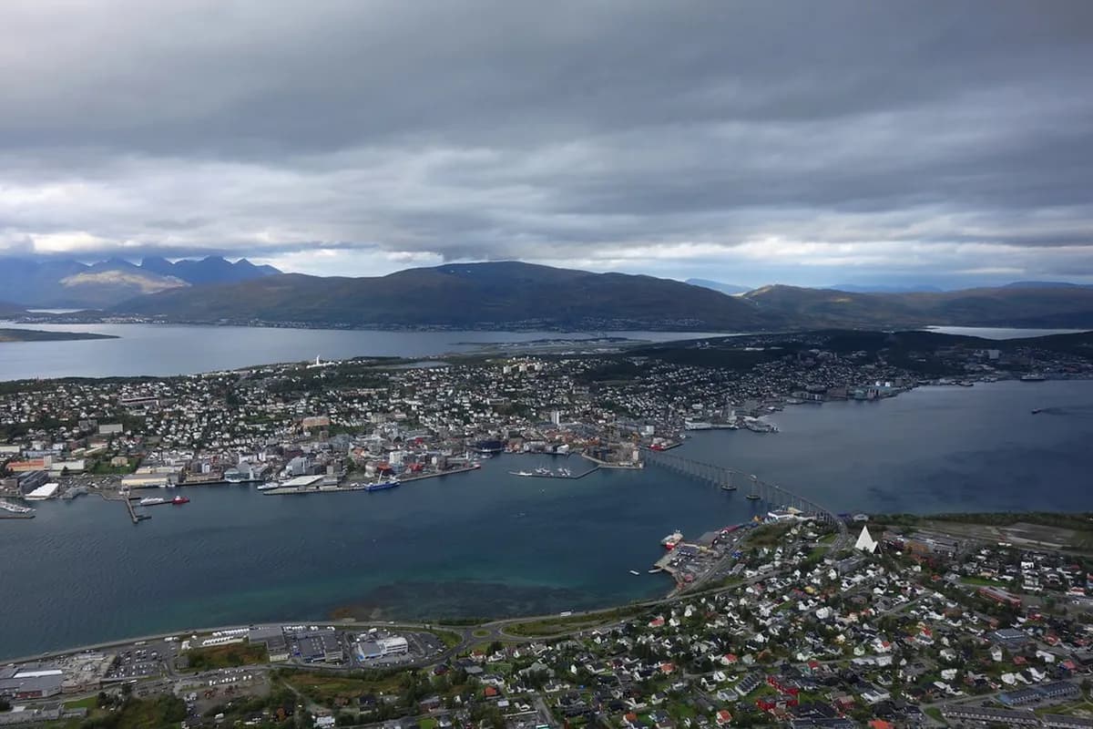
Kvaløya stands as a wild and rugged neighbor to the bustling city center of Tromsø. This massive island offers everything from jagged mountain peaks to serene white sand beaches. Travelers can reach this wilderness in minutes by crossing the iconic Sandnessund Bridge. For broader Arctic adventure options in the region, check official tourism resources.
Known as "Whale Island," this destination provides some of the best day trips from Tromso for nature lovers. The island serves as a perfect microcosm of Northern Norway's diverse landscapes. You will find ancient history, powerful nature, and quiet fishing villages along its winding coastal roads.
Why Kvaløya is Known as "All of Northern Norway in One Island"
Kvaløya is Norway's fifth-largest island and features a stunning variety of terrain. High mountains rise directly from the deep fjords, creating a dramatic vertical landscape. The eastern side feels lush and sheltered, while the western coast faces the raw Arctic Ocean. This geographic diversity makes the island feel like a complete regional tour in a single day.
The island's highest peak is Mount Blåmannen at 1,044 metres. Visitors often see reindeer grazing near the roads even during the short summer months, as the Oskal Sami family grazes their herds here year-round. The landscape transitions quickly from dense forests to barren, moon-like plateaus. Exploring the 137-kilometre loop allows you to witness these dramatic shifts firsthand.
Driving the Kvaløya Loop: The 137km Scenic Route from Tromsø
The classic Kvaløya circuit takes roughly three hours of driving without stops — plan a full day to do it justice. From central Tromsø, follow the signs toward the airport and cross the 1,222-metre Sandnessund Bridge onto the island. At Eidkjosen, turn left onto Road 858. The suburbs fade quickly into farmland and the proper Arctic landscape begins.
The basic loop runs south along the 858, past Skavberg and Hella, then east toward Brensholmen before swinging back through the mountain pass at Kattfjordeidet and returning via Ersfjordbotn. Adding the northern detour to Grøtfjord and Tromvik extends the total to around 190 kilometres. Road numbers to note: 862 for the eastern leg to Sommarøy and 7768 for the western fjord detour. Fuel up before leaving Tromsø — petrol stations are sparse once you leave the residential fringe near the bridge.
Winter driving is possible but demands experience. The narrow roads become icy and reindeer move unpredictably across all lanes. If you have not driven on snow before, consider a guided northern lights tours Tromso vehicle rather than renting your own car for a winter circuit.
Reindeer often wander onto roads, especially dawn and dusk. Winter roads ice quickly and can become dangerous in hours. Always fuel up in Tromsø—stations are scarce beyond the residential areas.
The Ancient Skavberg Rock Carvings (Stone Age History)
Ancient hunters left their mark on the rocks at Skavberg over 7,000 years ago. These carvings were made when the sea level was much higher than it is today, and post-Ice Age uplift has since raised them well above the waterline. You can find depictions of reindeer, elk, and mysterious geometric patterns etched into the stone. The site offers a fascinating look at the spiritual life of early Arctic inhabitants. Learn more about Norwegian rock carvings across the country's regions.
One specific carving has sparked a long-running debate among locals and archaeologists. The figure resembles a shaman's drum, but many people think it looks like a modern tennis racket. A separate male figure may depict a hunter, or could be interpreted as a stylized map of the surrounding fjords. Near the parking area, a younger field of Neolithic carvings features farm animals — and what appears to be a cat.
The carvings are on private farm land. Stay well clear of the farmhouse, avoid touching any plantings or equipment, and walk carefully on the smooth, sometimes slippery rock surfaces. Early morning light brings out the carved lines most clearly and avoids crowds.
Hella: Historic Houses and the Rystraumen Tidal Current
Hella is a beautiful coastal area that preserves the architectural history of Tromsø. In the 1960s, as Tromsø expanded rapidly, working-class houses and traditional stilted warehouses were demolished to make way for concrete. Some were rescued and relocated here, where they now form a photogenic ensemble with stunning views of the fjords and mountains behind. On warm days locals come to fish and camp on the rocks.
The Rystraumen tidal current flows directly past Hella with considerable force — it is the strongest ocean current along the entire Hurtigruten coastal route. The channel narrows around the island of Ryøya, producing powerful whirlpools and standing waves. Seagulls dive repeatedly as shoals of coalfish churn the surface. Norwegian tide charts (check Kartverket's online tide tool at kartverket.no) publish four tidal cycles per day for this strait, so you can time your visit to the hour of maximum flow.
Exercise real caution near the water. Smooth rocks at the water's edge become dangerously slick when wet. The current is strong enough that falling in during peak flow is potentially fatal. Keep children well back from the edge and skip weighted lures, which snag the bottom and threaten seabirds.
Straumen Gård and the Dark Folklore of Ryøya
A few hundred metres past Hella stands Straumen gård, one of the best-preserved 19th-century coastal farms in all of Northern Norway. The ochre main building is surrounded by smaller outbuildings, log cabins in weather-beaten barn red and shiny grey, and a fenced kitchen garden. Visitors are welcome to wander the grounds and peer through the windows; the small museum opens occasionally for special events. The view back toward the Bentsjordtindan peaks is exceptional and rarely photographed.
The small island of Ryøya, sitting in the middle of the Rystraumen current just offshore, carries a grimmer story that most guides skip. In 1742 a young woman named Birte was executed there alongside her brother Benjamin after she killed her abusive older husband. The case went to the Supreme Court of Denmark-Norway in Copenhagen. The documents later burned in a fire, leaving the full story permanently in shadow. Local historians call the island's western tip Stegelnesset — "stake point" — a name that needs no explanation.
Sommarøy: The Arctic's White Sand Paradise
Sommarøy is a vibrant fishing village of around 300 people located on a cluster of islands just off the western coast. The area is famous for its turquoise water and brilliant white coral-sand beaches. Many visitors consider Sommaroy from Tromso to be the ultimate scenic detour on any Tromsø itinerary. The village maintains a strong connection to the sea through its active fishing fleet.
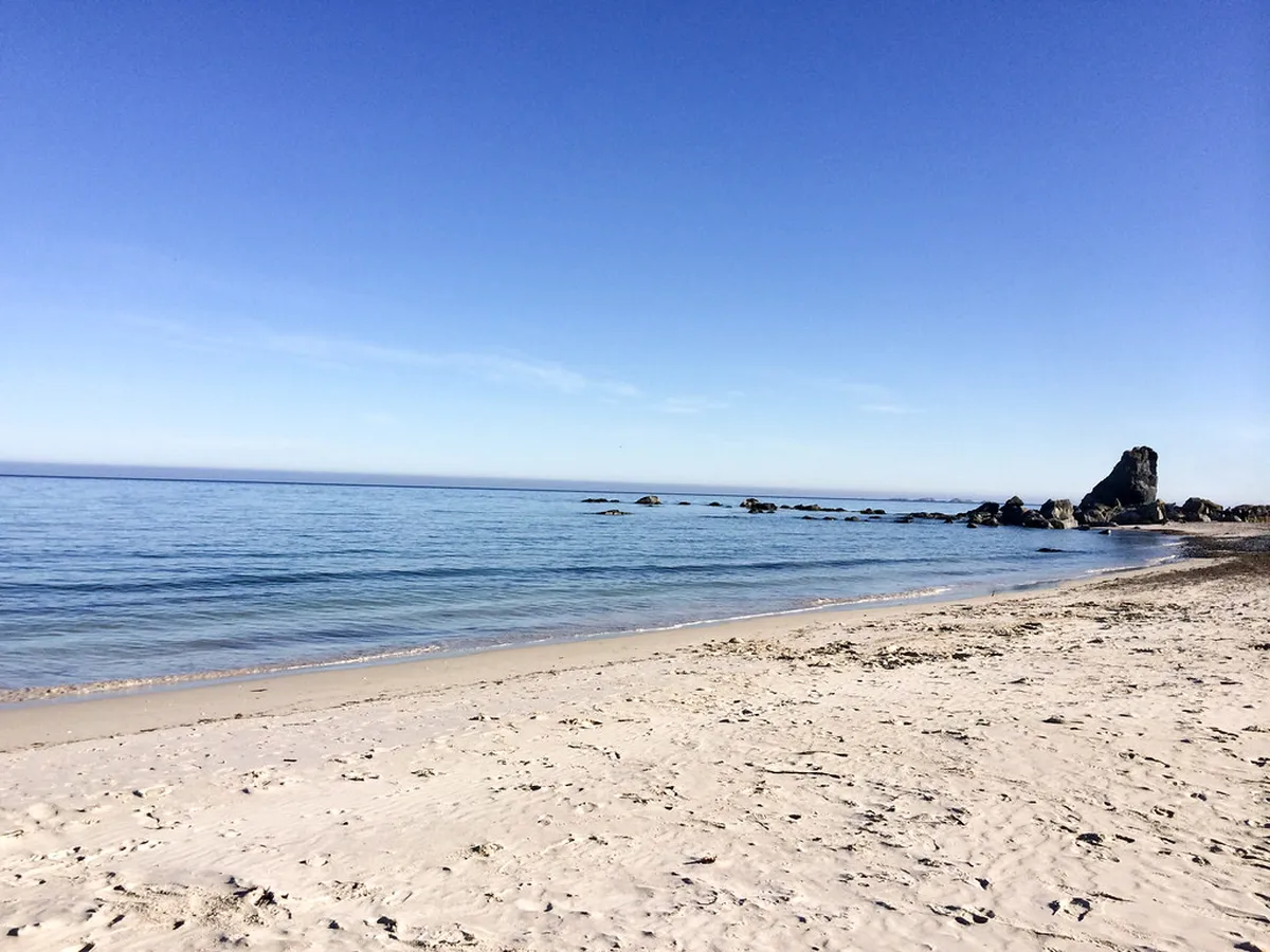
Walking the narrow roads across the bridges connecting the small islands gives panoramic ocean views in every direction. The silhouette of the Håja cliff island to the north and the distant Senja island mountains to the south frame the scene perfectly. For coffee, try Havfrua in the village; for a full meal, the Sommarøy Hotel restaurant is a solid choice. The crystal-clear water looks tropical, though it remains bracingly cold year-round — hardy swimmers still go in.
Summer (Jun–Aug) is peak season for Sommarøy's white sand beaches and midnight sun. Winter brings aurora chasing and snow-covered peaks. The village is a must-see detour on any Kvaløya loop.
Hiking Kvaløya: From Mount Brattfjellet to Hillesøytoppen
Hiking is the most popular way to experience the island's vertical beauty during the summer months. Trails range from easy coastal walks to challenging climbs up rocky ridges above the treeline. Always carry a map, pack extra layers, and check the weather forecast before starting any ascent — conditions can switch in under an hour.
| Trail | Elevation | Difficulty | Duration | Highlights |
|---|---|---|---|---|
| Mount Brattfjellet | 557 m | Moderate | 3–4 hrs return | Panoramic Ersfjord views; most-photographed summit |
| Hillesøytoppen | 211 m | Easy/Moderate | 1 hr return | Sommarøy archipelago and open ocean horizon |
| Mount Buren | 802 m | Moderate/Hard | Full day | South coast and Senja views; less crowded |
| Mount Vasstinden | 900 m | Hard | 5–6 hrs return | Highest accessible peak; exposed ridge section |
| Ørnfløya Hill | ~400 m | Easy | Short | Malangskjeften inlet views; good for time-pressed hikers |
For all routes above 500 metres, bring micro-spikes between October and May. Snow lingers on north-facing slopes well into June in 2026 conditions.
Pack extra layers and waterproof clothing even for summer hikes—Arctic weather can shift from sunshine to heavy snow within an hour. Check the forecast before any ascent and always carry a map.
Chasing the Northern Lights by Car: Best Coastal Routes
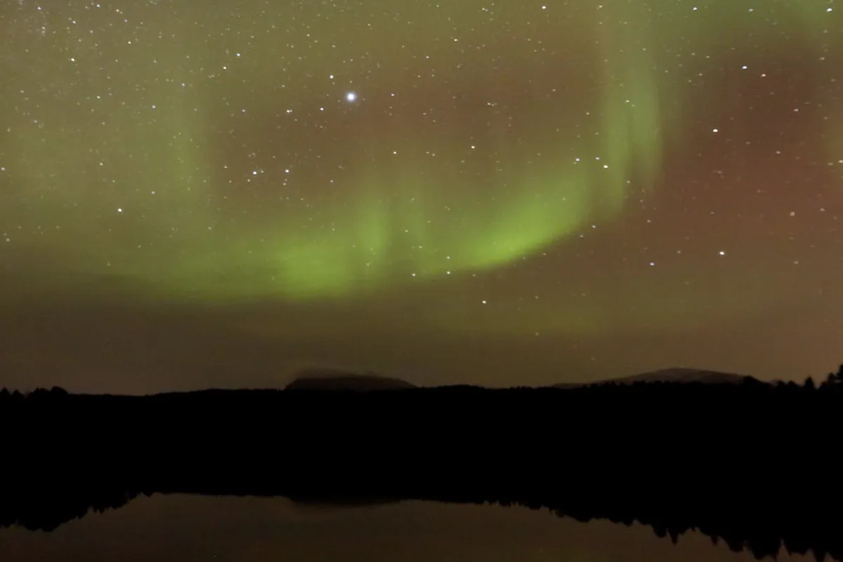
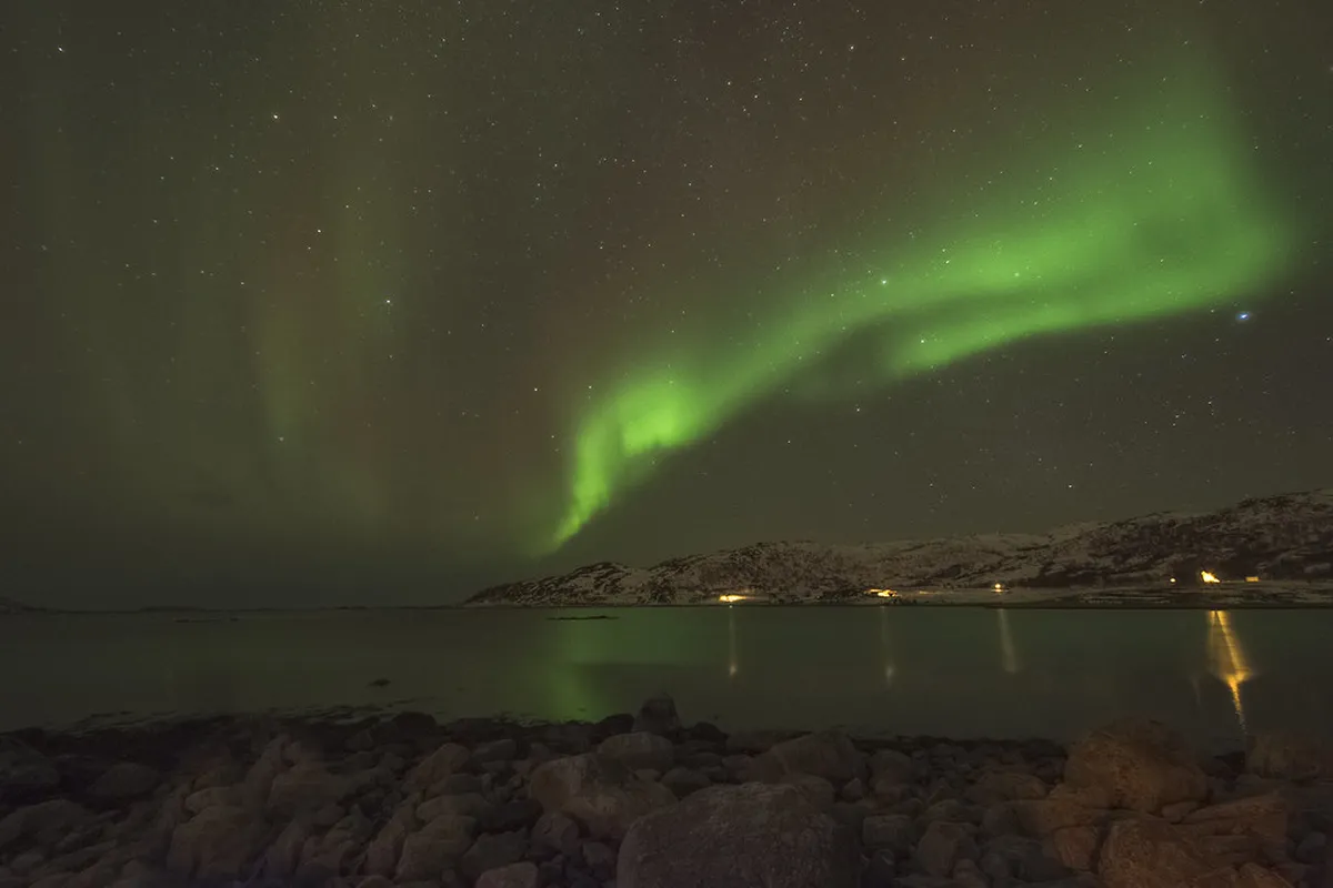
Kvaløya is one of the best places to see the Aurora Borealis near the city. The lack of streetlights along the western fjords provides perfectly dark skies, and the mountain walls of Ersfjordbotn create a natural frame for photographs. Driving your own car allows you to move quickly when the clouds begin to clear. Pull-offs near Ersfjordbotn and along the Grøtfjord road are wide enough for two cars and safe to use at night.
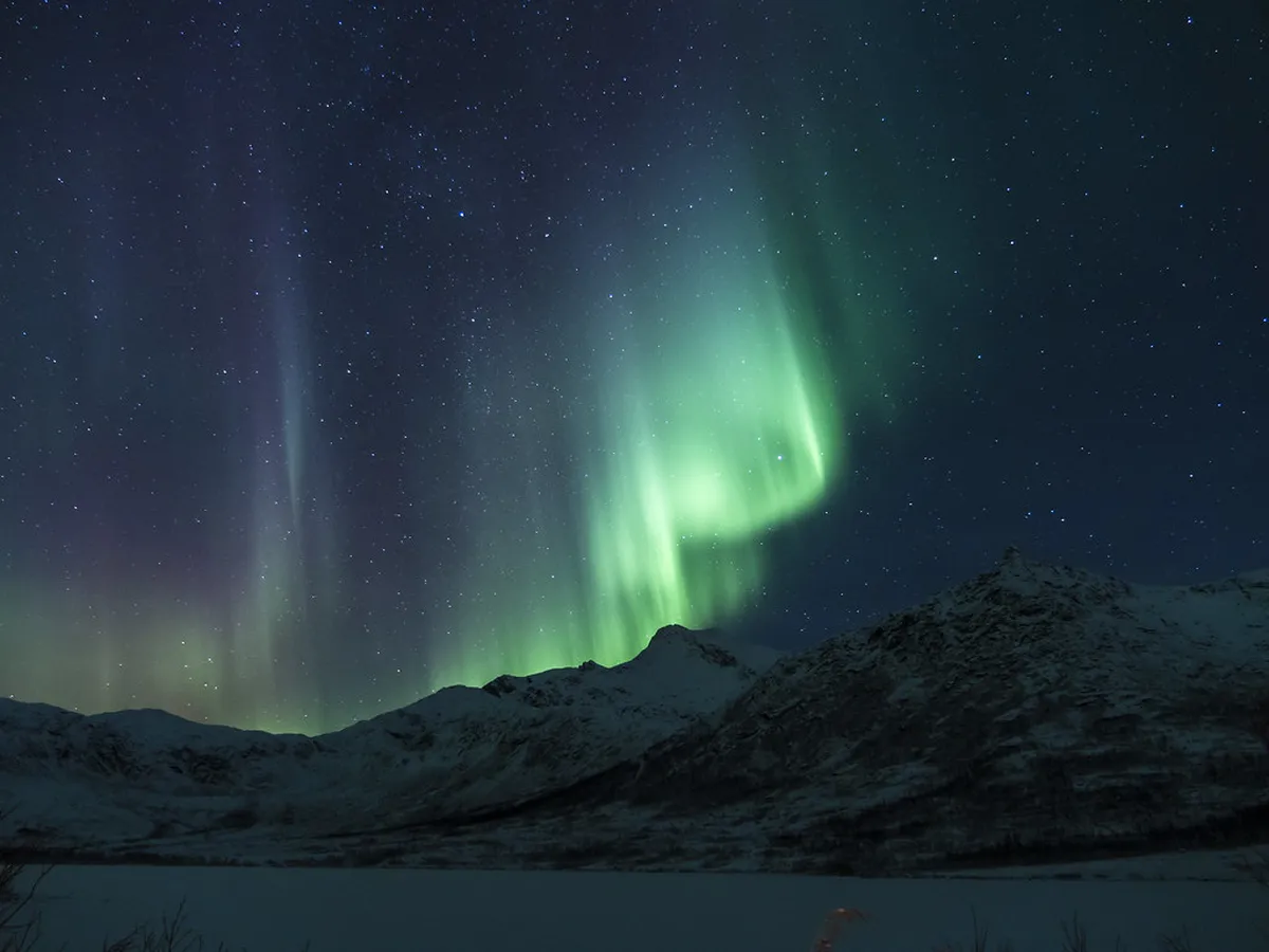
Many travelers prefer booking a guided northern lights tours Tromso trip for expert cloud-chasing logistics. Professional guides monitor the forecast in real time and know which valleys open up when the coast clouds over. The coastal roads can ice over quickly in winter, so carry snow chains and keep your speed well below the limit. Always wear reflective gear if you plan to stand near the roadside in the dark.
The Tirpitz Memorial and Håkøya's War History
Håkøya is a small island connected to the main Kvaløya road by a flat timber bridge — easy to miss if you are driving fast. This quiet spot holds a significant place in World War II history. The German battleship Tirpitz was sunk here by British Lancaster bombers in November 1944, resulting in nearly 1,000 casualties. A simple memorial stands near the shore to honor those who lost their lives. Visit this memorial site to learn the full history of the battleship's final days.
You can still see remnants of the massive hull during very low tides, and information boards at the site explain the military operation in detail. The area around the memorial is now peaceful — good for birdwatching and short coastal walks. This detour adds minimal distance from the main loop road and is worth the ten minutes it takes. It is the kind of stop that reframes the island's wartime role in a way that many visitors do not expect.
Dramatic Fjords: Ersfjordbotn, Grøtfjord, and Tromvik
Ersfjordbotn is arguably the most photographed location on the entire island. The fjord is enclosed by 1,000-metre peaks that turn amber and rose during the golden hour — typically around 22:00 in midsummer or 14:00 in mid-winter. Small red fishing huts line the shore, providing the classic Norwegian coastal aesthetic. The café Bryggejentene here is extremely popular with Tromsø locals and worth stopping at for coffee and cake.
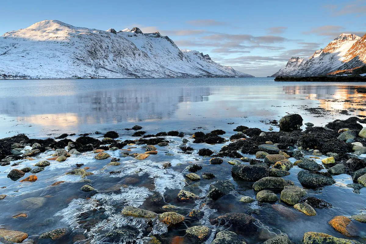
Further north, Grøtfjord offers a surprisingly large sandy beach facing the open Atlantic, popular on warm days with sunbathers from Tromsø. The road continues past the village into progressively more dramatic scenery before arriving at Tromvik, a compact village of around 100 people where the pavement eventually ends. From Tromvik the narrow road continues to Rekvik, where a handful of residents hold front-row views of the open ocean. Turning around at Rekvik gives you the feeling of having genuinely run out of road.
Practical Planning: Driving, Weather, and Local Tips
Driving on the island is a highlight, but it requires awareness of local hazards. Reindeer often wander onto the roads and through roundabouts, particularly in the early morning and near dusk. Slow down immediately if you spot one — more will almost always follow from the surrounding terrain. Wild elk also use the roads year-round, especially on the eastern side of the island near farmland.
Weather on Kvaløya can change from bright sunshine to heavy snow within the hour. Always pack extra layers and waterproof clothing even for short summer excursions. Check Tromso travel tips for current Arctic driving conditions before heading out. Fuel stations are limited once you leave the main residential areas near the bridge, so fill up and buy snacks in Tromsø before setting off.
Public bus service is infrequent and does not reach the western fjords or Sommarøy conveniently. For Sommarøy and the full loop, a rental car is the only practical option. For updated public transport schedules consult Svipper, the regional transport authority for Troms county.
For related Tromsø planning, see our guides to Sommaroy Day Trip From Tromso: A Perfect 1-Day Itinerary and Senja Day Trip From Tromso: 8 Things to Know Before You Go.
Frequently Asked Questions
How do I get from Tromsø to Kvaløya?
You can easily reach Kvaløya by driving across the Sandnessund Bridge from the main island. Public buses also run frequently to residential areas like Kvaløysletta. For the best experience, renting a car allows you to explore the remote fjords and beaches at your own pace.
What is the best time of year to visit Sommarøy?
Summer is the most popular time to visit Sommarøy for hiking and enjoying the white sand beaches. However, winter offers a magical atmosphere with snow-covered peaks and a high chance of seeing the Aurora. Check the best time for northern lights in Tromso to plan a winter trip.
Can you see the Northern Lights on Kvaløya?
Yes, Kvaløya is one of the premier locations for Aurora watching due to its low light pollution. The western fjords like Ersfjordbotn and Grøtfjord provide dark skies and dramatic mountain backdrops. Many self-drive visitors head here to escape the city lights of Tromsø.
Are there reindeer on Kvaløya?
Reindeer are very common on the island and are often seen grazing by the roadside. They are semi-domesticated and owned by local Sami herders who use the island for summer grazing. Drivers should always remain alert and prepared to stop for animals crossing the road.
Kvaløya offers an unforgettable escape into the heart of the Norwegian Arctic. From the ancient rock carvings at Skavberg to the modern beauty of Sommarøy, the island never ceases to amaze. It provides a perfect balance of accessible adventure and deep historical roots.
Whether you are chasing the Northern Lights or hiking mountain ridges, this island has it all. Plan your route carefully to see the best fjords and historic sites along the way. The wild beauty of the island will likely be the highlight of your entire trip to Northern Norway.
You might also like
Continue reading
More guides you'll find useful